Jump to content


Photo

Google map import


  • Please log in to reply
14 replies to this topic

#1 Luke Utecht

Luke Utecht

    Member

  • Members
  • PipPip
  • 14 posts

Posted 20 December 2016 - 10:03 AM

Hello, our company is working on making a title page for our plans.  We are trying to add a space on our title page that we can show a "job location" map from Google.  Does anyone know of a quick/fast, easy way to accomplish this in Softplan?  First issue we have been having is figuring out how to save a google map image easily.  After that i am sure it is just an import of the image.  But if there is a way we can "link" a designated space on the title page to a map, it would be easier.  Any help or thoughts on this are appreciated!


#2 Yvon Gonthier

Yvon Gonthier

    Advanced Member

  • Members
  • PipPipPip
  • 1,288 posts
  • LocationOttawa

Posted 20 December 2016 - 10:11 AM

You can use tools such as Windows Snipping Tool or other programs to save your map as a Jpeg than insert with the import image. Don't know of a way to create a link.


#3 Keith Almond

Keith Almond

    Advanced Member

  • Members
  • PipPipPip
  • 5,096 posts
  • LocationBrockville, Ontario, Canada

Posted 20 December 2016 - 10:39 AM

No, I don't believe you can create a link ... apart from the Softplan files, you are limited to JPG, EMF and if you have Review PDF.


Keith

There are 10 types of people in this world ....... Those who understand binary, and those who don't.

Softplan user since version 5.5.2.5

www.homehardwarekingston.ca

#4 Troy Lachcik

Troy Lachcik

    Advanced Member

  • Members
  • PipPipPip
  • 71 posts

Posted 20 December 2016 - 11:51 AM

can you please explain what you are looking for and how you would like to access the map? there is a way to do it but do you want to access the map our do you want a client to be able to access the map?


#5 Troy Lachcik

Troy Lachcik

    Advanced Member

  • Members
  • PipPipPip
  • 71 posts

Posted 20 December 2016 - 11:52 AM

I am sorry. I ment to say there might be a way.


#6 D M

D M

    Advanced Member

  • Members
  • PipPipPip
  • 402 posts
  • Location..

Posted 20 December 2016 - 02:47 PM

Once in Google Maps, .. Print Srcn should work well enough, .. Paste it into any paint program and save the file


Import image into Softplan


.. unless I'm not catching all that you're trying to accomplish


(image Courtesy © of Google Maps,.. obviously) (so, .. take that into consideration as well )


.. invariably, someone will have a simpler solution.


#7 Luke Utecht

Luke Utecht

    Member

  • Members
  • PipPip
  • 14 posts

Posted 20 December 2016 - 03:40 PM

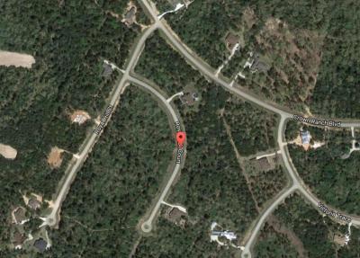
This is a sample from another plan that we have seen and we are trying to do something similar.  We basically are trying to do exactly what some of you are suggesting by making a print screen or snippit and pasting or importing in.  Just did not know if there was a faster way...

Attached Thumbnails

  • Capture.JPG


#8 Carole Berg

Carole Berg

    Member

  • Members
  • PipPip
  • 17 posts

Posted 21 December 2016 - 12:15 PM

We use the same procedure as Yvon and Douglas. Go to the map you want to include on your page and use the windows snipping tool to capture exactly what you want to include. First, when you search google maps for the address, Google usually puts a marker on the address.  Then you can snip it to include any diameter around the marker as you wish.  Save it as a jpg or other preferred format, then import it onto your Softplan title page. It works great.  Plus, when the plans are printed, those reading the plan set can easily identify the location of the project without having to enter the google address into their phone as a link would require. 


#9 Brian Berzinskis

Brian Berzinskis

    Advanced Member

  • Members
  • PipPipPip
  • 470 posts
  • LocationNew Jersey

Posted 08 January 2017 - 06:53 PM

FYI when you use the Snipping Tool it automatically copies the image to the clipboard and then you can go to Edit > Paste from Windows Clipboard > Image if you want to skip the part of saving the file and then navigating to the file on import.


#10 Warren Ducote

Warren Ducote

    Advanced Member

  • Members
  • PipPipPip
  • 274 posts
  • LocationMontgomery, Texas

Posted 09 January 2017 - 07:20 AM

I use a small program call "EasyCapture" and its free.dddddd.jpg


#11 Nicole Mayrose

Nicole Mayrose

    Newbie

  • Members
  • Pip
  • 2 posts

Posted 03 September 2019 - 02:03 PM

Is there anyway to use this with a scale to it?  


#12 Heath Foster

Heath Foster

    Advanced Member

  • Members
  • PipPipPip
  • 177 posts

Posted 03 September 2019 - 02:20 PM

Is there anyway to use this with a scale to it?


If you know the size of something in the picture (like the length of a property line) you can you use the adjust size tool to scale it based of that measurement.

#13 Brian Berzinskis

Brian Berzinskis

    Advanced Member

  • Members
  • PipPipPip
  • 470 posts
  • LocationNew Jersey

Posted 04 September 2019 - 10:36 AM

Is there anyway to use this with a scale to it?  


Google Maps does have a visual scale down in the bottom right corner of the screen.


#14 Dennis Hilborn

Dennis Hilborn

    Advanced Member

  • Members
  • PipPipPip
  • 816 posts
  • LocationDFW Texas

Posted 04 September 2019 - 02:57 PM

Google earth has a "Ruler" function under the Tools menu.


#15 Brian Berzinskis

Brian Berzinskis

    Advanced Member

  • Members
  • PipPipPip
  • 470 posts
  • LocationNew Jersey

Posted 10 September 2019 - 04:15 PM

I use a small program call "EasyCapture" and its free.attachicon.gif dddddd.jpg


The Snipping Tool if you are ever interested in it, is actually installed in Windows. It comes with Windows 10 also and has been around for a few versions before that.


0 user(s) are reading this topic

0 members, 0 guests, 0 anonymous users